|
Murals' Locations with
GPS:
Manning
https://www.youtube.com/watch?v=LLqZQ1I8n0w
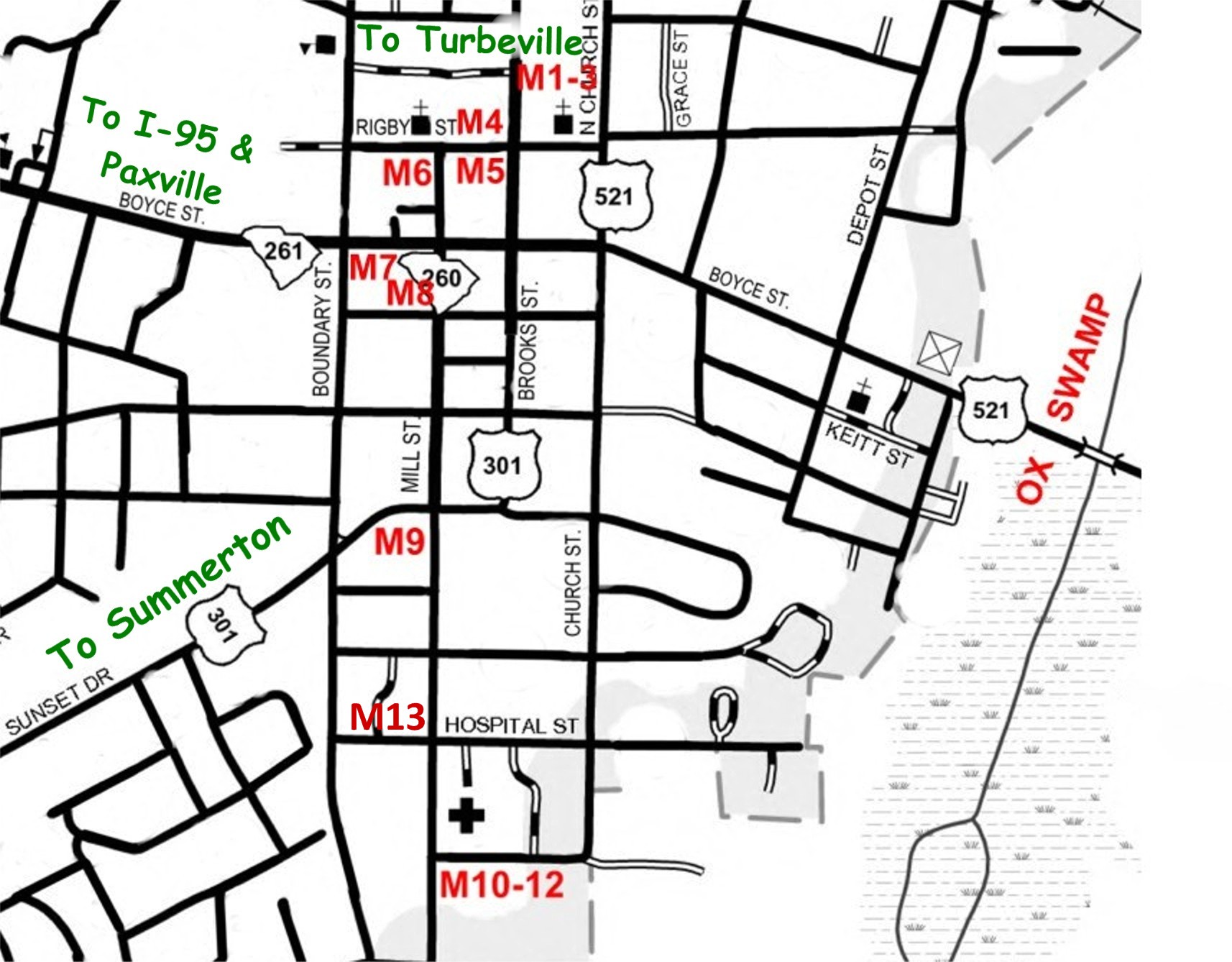
Manning:
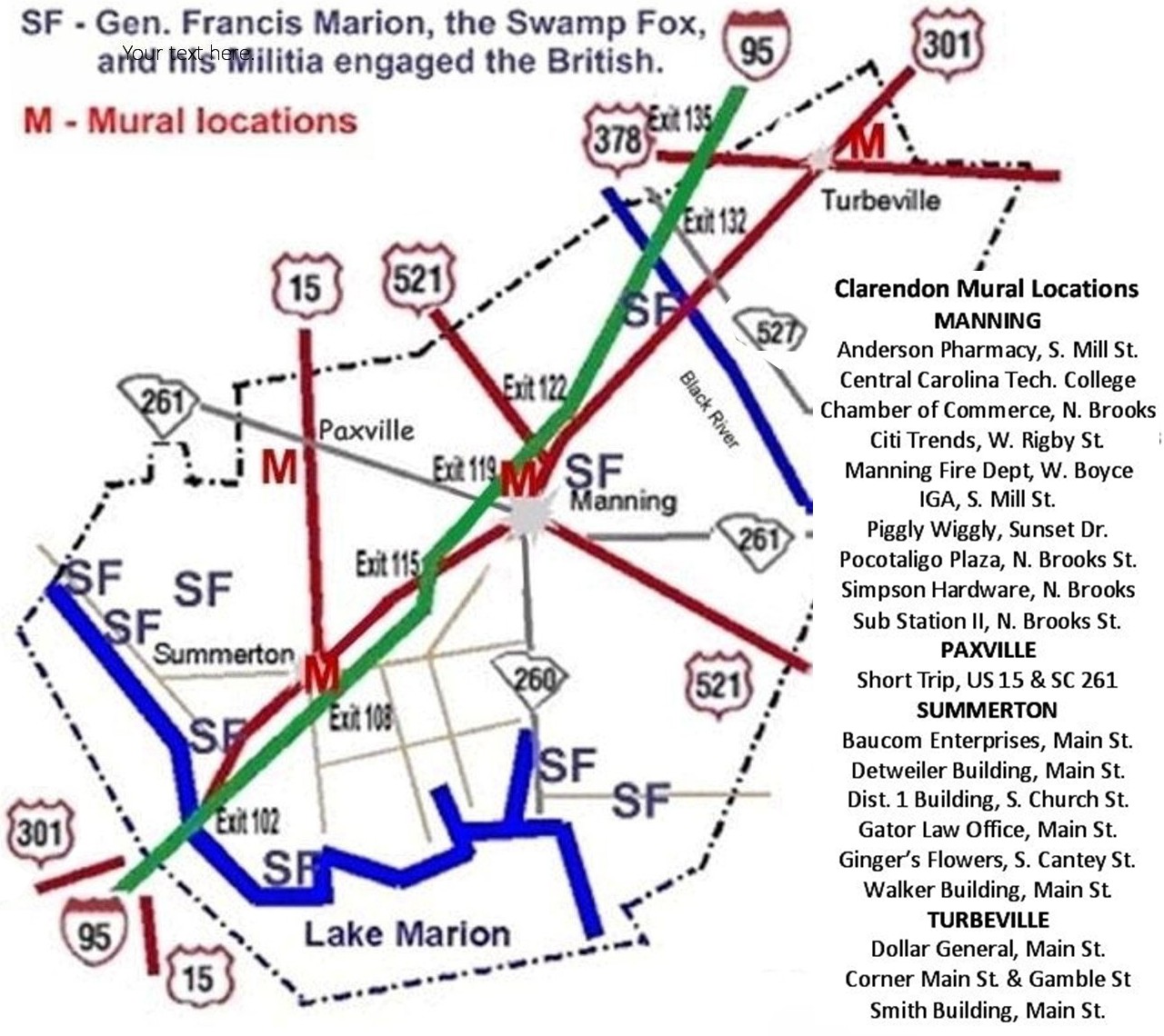
Mural & statue sites list South to North:
M 10-12 Wyboo Swamp
- IGA, S. Mill St.: 33°41'9.7"N 80°12'39"W
M 13
Marion Militia Needs, Anderson Pharmacy,
S. Mill St.:
33°41'16.8"N 80°12'45"W
M 9 Citizen Soldier - Piggly
Wiggly,
S. Mill St.: 33°41'26.6"N 80°12'44.6"W
M 9 + Waiting
in Ambush - Piggly Wiggly,
S.
Boundary St.:
33°41'26.0"N 80°12'47.44"W
M 7 Swamp Fox at Ox
Swamp - Manning Fire Dept.,
Boyce St.: 33°41' 42"N
80°12' 47"W
M 6 Reflections - Citi
Trends,
Mill St.: 33° 41' 47" N 80° 12' 42.6" W
M 8
Marion Statue - Clarendon Chamber,
N. Brooks St.: 33° 41' 42.4"
N 80° 12' 43.5" W
M 5 The Swamp Fox
- Sub Station II,
N. Brooks St.: 33° 41' 46.5" N 80° 12' 39"
W
M 4 Half-Way Swamp
- Domino's Pizza,
N. Brooks St.: 33° 44' 19" N 80° 21' 28" W
M 1-3
Pond Bluff to St. Stephens Church - Simpson Hardware,
N. Brooks St.: 33° 41' 51.6" N 80° 12' 36" W
Marion Sculpture - FE DuBose Campus, Central Carolina
Technical College,
US 521: 33°4333 N, 80°1156.4 W
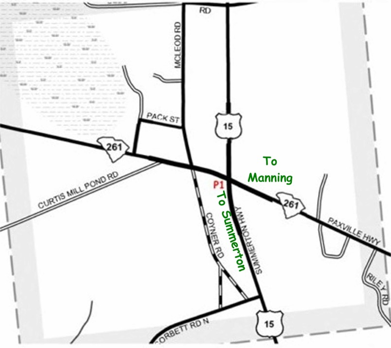
Paxville (at stoplight):
P 1 Richbourg Mill to
Ox Swamp - Short Trip,
US 15 & SC 261: 33°
44' 18.4" N 80° 21' 27.4" W
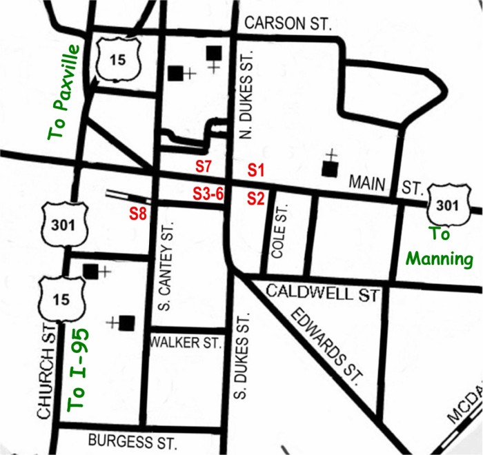
Summerton: Mural sites listed North to South
S 1 The Patriot -
Gaters, North side
Main St.: 33° 36' 29.3" N 80° 20' 56.7" W
S 2 The Redcoat -
Detwilers, South side
Main St.: 33° 36' 28.7" N 80° 20' 56.8" W
S
3-6 Siege of Fort Watson - Summerton Hardware,
Main St.: 33° 36'
28.7"N 80° 20' 58.6"W
S 7 Wagon Travel
- Walker Bldg.,
Main St.: 33° 36' 29.7" N 80° 20' 59.9" W
S
8 Patriot at Scotts Lake - Gingers,
S. Cantey
St.: 33° 36' 28" N 80° 21' 05" W
S
9 Elusive Marion - Opposite School District 1,
S.
Church St.: 33° 36' N 80° 21' W
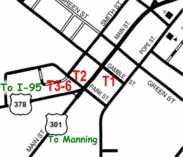
Turbeville: Mural
sites listed East to West
T 1 Puddin Swamp
- Formerly Griffin Drug Store,
Main St.: 33° 53' 26.8" N 80° 01' 08.1" W
T
2 New Tearcoat Swamp - Dollar General,
Main St.:
33° 53' 25.7"N 80° 01' 14.5"W
T 3-6 Burning of Mouzons
- Formerly Older Post Office,
Corner of Main & Gamble Sts - 2 sides:
33° 53' 24.5" N 80° 01' 13.4" W & 33° 53' 24.3" N 80° 01'
13.8" W
|